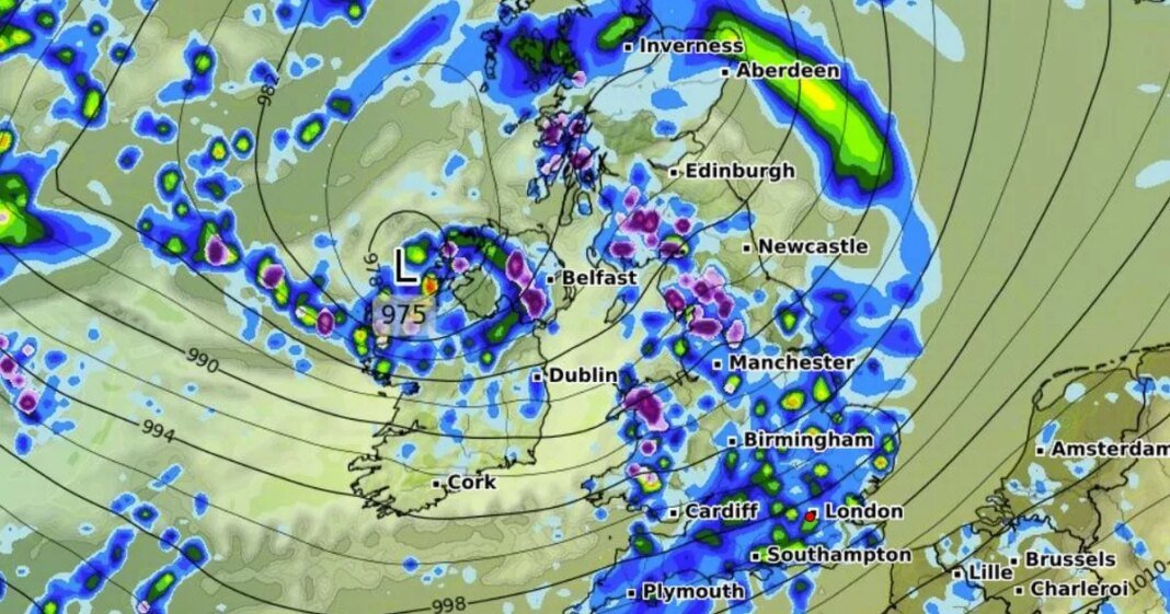
More snow is on the cards for Brits this month as a fierce Artic storm looks set to impact all parts of the country.
Although temperatures are expected to improve in the coming days following snow and hail this week, advanced weather modelling maps suggest more wintry conditions are right around the corner. The GFS weather model shows snow first coming down in Northern Ireland and western parts of Scotland, England and Wales at around midday on March 26. Rain is expected to fall across much of the UK at the same time.
By 6pm the snow is tracked to move northward, with scattered but intense flurries coming down across northern parts of England, most of Scotland and most of Northern Ireland. Where flurries are most intense, data suggests snow could be falling at a staggering rate of 5cm per hour.
Flurries should continue into the early hours of March 27 in central and northern Scotland. The maps suggest every part of the UK will either see snow or rain within this 18-hour period.
Forecasters at Netweather say that although there should be “plenty of warm dry sunny weather” later this month, cold and unsettled spells are also possible. The Netweather forecast for March 24 to March 30 states: “This week looks set to start off with high pressure close to the east of Britain, so it may well start off quite similar to what we saw during the first week of March, with plenty of warm dry sunny weather especially for eastern and southern Britain.
“However, particularly with the recent stratospheric warming event, we have a long-term signal for pressure to fall again to the south of Britain especially as we head towards the south of April. This means that we may increasingly pull in easterly and south-easterly winds, bringing cooler cloudier weather especially to eastern counties, and it may also turn more unsettled towards the end of the week, particularly in the south.
“Overall, it will probably be warmer and drier than average overall due to a warm dry start to the week. Sunshine will probably end up near normal in most southern and eastern parts of Britain and above normal in the north-west.”
The Met Office forecast for March 18 to March 27 states: “High pressure is expected to be centred to the east of the UK for much of next week. Initially there should be a good deal of dry weather with sunny spells by day, but still the potential for some chilly nights at first. Daytime temperatures will probably start around average, but gradually increase day by day.
“As we move towards the weekend and into the following week, we are likely to see a gradual transition to less settled conditions. So rain or showers are expected at times, mostly focussed across the south and west at first, then more widely later. With winds predominantly coming from the south or southwest it will also become much milder, possibly warm in places.”
At Reach and across our entities we and our partners use information collected through cookies and other identifiers from your device to improve experience on our site, analyse how it is used and to show personalised advertising. You can opt out of the sale or sharing of your data, at any time clicking the “Do Not Sell or Share my Data” button at the bottom of the webpage. Please note that your preferences are browser specific. Use of our website and any of our services represents your acceptance of the use of cookies and consent to the practices described in our Privacy Notice and Cookie Notice.

