
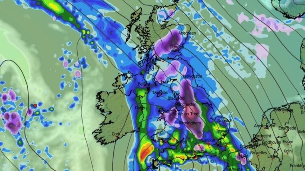

A significant weather event is expected to impact the United Kingdom next week, with heavy rain and snowfall predicted in various regions. Advanced weather models indicate that snowfall is likely in Wales, the Midlands, northern England, and Scotland starting early Tuesday, with intense snowfall rates of about one inch per hour in hilly areas.
The snowfall is projected to intensify during the morning hours, with potentially heavy snowfall of around four inches per hour in the Peak District by 9 am. Cities like Manchester and Birmingham are expected to experience snow reaching low-lying areas. Some parts of southern England may also see snowfall, while most southern regions can anticipate heavy rainfall.
By mid-afternoon, the ECMWF model forecasts suggest that snow showers will become more scattered, affecting regions like the south-west, East Anglia, Wales, Northern Ireland, and parts of northern England and Scotland. Snowfall may intensify again in the evening over Yorkshire and the Pennines, with northern England likely to experience four inches per hour snowfall by 9 pm.
Snow depth charts indicate that southern UK regions are unlikely to see significant snow accumulation, with the Scottish Highlands expecting up to 69cm of snow, while northern England hills may receive 24cm. Wales and Northern Ireland could see 7cm and 2cm of snow, respectively.
The Met Office also predicts snowfall in the upcoming week, mentioning unsettled weather patterns with rain moving across the country and a growing risk of snow, especially over northern hills. From Wednesday to February 6, weather systems from the Atlantic may bring heavy rain and showers, with colder conditions leading to wintry showers, potentially resulting in snow over hills and other areas.
BBC forecasters also anticipate snowfall next week, with rain transitioning to snow over higher ground in north Wales, northern England, and Scotland. Another band of rain and hill snow could move in later in the week, followed by showery conditions.